
Ein beliebter Fotospot für Touristen in Shibuya: Diese Kreuzung befindet sich direkt am nordwestlichen Ausgang (Hachiko-Ausgang) des JR-Bahnhofs Shibuya. Sie gilt als die verkehrsreichste Kreuzung der Welt und ist zu einem Wahrzeichen Tokios geworden. Von der Verbindungsbrücke zwischen der JR-Yamanote-Linie und der Keio-Inokashira-Linie aus kann man die Fußgänger beim Überqueren der Straße beobachten … Weiterlesen
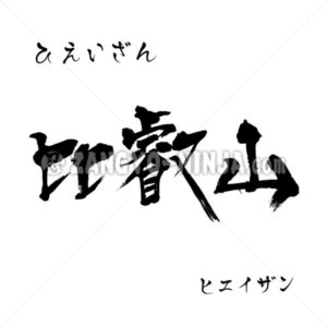
Mount Hiei, also known by the famous name “Fuji of the Capital,” as well as Eizan, Hokurei, and Tendai-san, is a mountain straddling western Ōtsu City in Shiga Prefecture and northeastern Kyoto City in Kyoto Prefecture. A mountain revered by ancient people Located on the border between Kyoto and Shiga Prefectures, it offers a … Read More
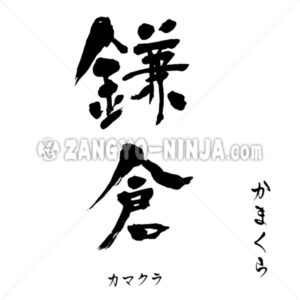
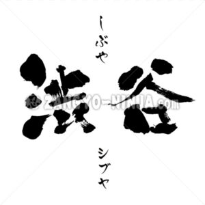
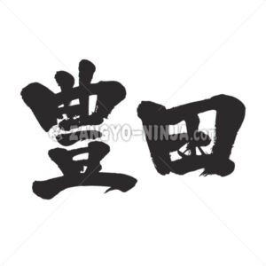
Shibuya exists both as a place name and as a surname. Shibuya as a place name (Tokyo) A ward located in the southwest of Tokyo’s 23 wards. In 1932 (Showa 7), the three towns of Shibuya, Sendagaya, and Yoyohata in Toyotama District merged to form Shibuya Ward. Regarding the station itself, in March 2013, … Read More

A mountain awarded three Michelin stars Mt. Takao is located in Hachioji City, Tokyo, at the western edge of the Kanto Plain. As it is located where the plain turns into mountainous terrain, trains run right up to the trailhead, making it very accessible. With an elevation of 599 meters, it is a low … Read More
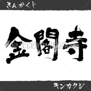
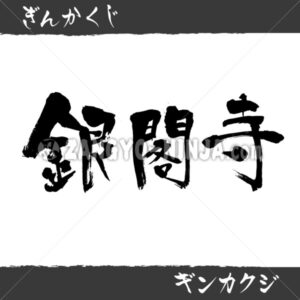
Description for Kinkaku-ji The golden World Heritage Site, Kinkaku-ji Temple. Its official name is Rokuon-ji Temple, but it is commonly known as Kinkaku-ji Temple because its most famous structure, the Shari-den Hall (Golden Pavilion), is covered in gold leaf. Located in Kita Ward, Kyoto City, it is a temple of the Rinzai sect’s Shokoku-ji … Read More
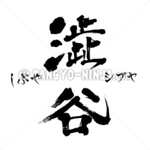
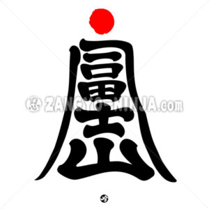
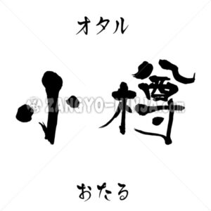
The first character in the center is the old character form of Shibuya. You hardly ever see it nowadays, but this character was used until around the early Showa period. It seems some Japanese people still use this old character form in their surnames. This character is a kanji meaning “bitter taste,” “to stagnate,” … Read More
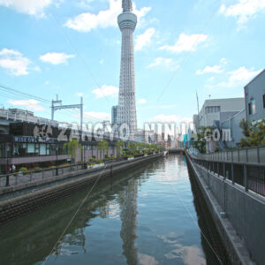
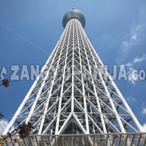
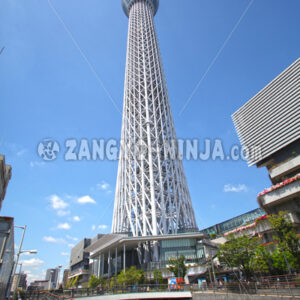
Es handelt sich um den höchsten freistehenden Sendeturm der Welt. Er befindet sich im Tokioter Stadtbezirk Sumida, nahe Asakusa, und ragt 634 Meter (Musashi) in die Höhe – der höchste Turm des Landes. Bevor der Skytree gebaut wurde, diente der Tokyo Tower diesem Zweck; aufgrund der zunehmenden Bebauung wurde jedoch der Skytree errichtet, um Radiowellen zu übertragen… Weiterlesen
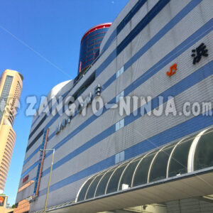
Hamamatsu ist nach Shizuoka-Stadt die zweitgrößte Stadt der Präfektur Shizuoka. Dieses Foto zeigt die Gebäude und den blauen Himmel direkt vor dem Nordausgang des Bahnhofs Hamamatsu, der in die Innenstadt führt. Das im Hintergrund sichtbare Gebäude ist das Okura Act City Hotel Hamamatsu. Dieses Foto war einst ein fester Bestandteil von … Weiterlesen
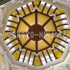
In 2012, the red-brick Marunouchi Station Building, a Nationally Designated Important Cultural Property, was restored to its original appearance. The reliefs on the ceilings inside the building were meticulously recreated by leading plasterers.
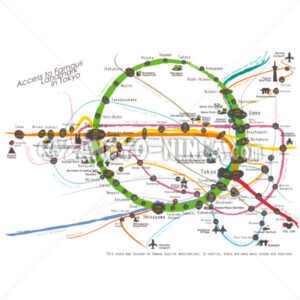
This work is a brush-style work of the lines (train and subway) to the famous landmarks of Tokyo. There are so many lines in Tokyo. The routes and transfer stations for going to the landmarks are listed. The file(vector ai file)is divided into layers by line, station name and station number for each layer. … Read More

A city in western Hokkaido. The location of the Hokkaido Government offices. The city name Sapporo originates from the Ainu word “Sato-poro” (dry, wide land). The first snowfall occurs around late October, with permanent snow settling in December. Snowfall is heavy, with an annual average accumulation of approximately 600 cm observed. However, extensive snow … Read More
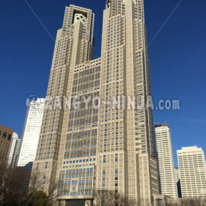
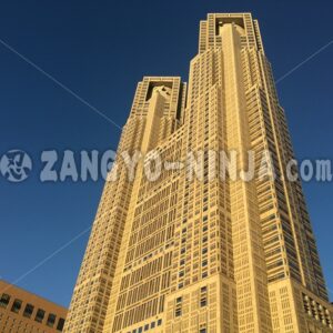
A district in the northern part of Minato-ku, Tokyo. In the Edo period, there were six daimyo (Uesugi, Kutsuki, Takagi, Aoki, Kabane, Ichiyanagi) Nakayashiki, and it is said that the place names are derived from the fact that the surnames of the six daimyo are all related to trees. It is also said that … Read More
A region along the coast of Hakata Bay in Fukuoka City, northwestern Fukuoka Prefecture. In a narrow sense, it was defined as the Ishido River in the east, the Naka River in the west, Hakata Bay in the north, and the Boshu Moat in the south. There are almost no remaining Boshu moat, and … Read More
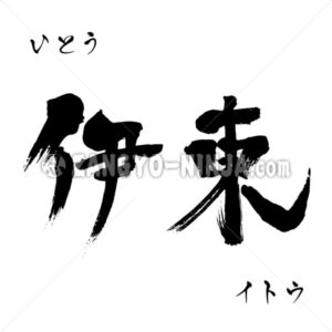
Ein Ort, der seit langem für seine Thermalbäder bekannt ist. Die Touristenstadt Ito liegt im Osten der Präfektur Shizuoka, nahe dem Zentrum der Izu-Halbinsel und gegenüber der Sagami-Bucht. Der Name Ito soll sich von der Lage östlich von Yu Izu ru kuni (dem Land, wo die heißen Quellen entspringen) ableiten. Itos Industrien … Weiterlesen
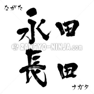
Hello, Mr. Nagata. This is an explanation of the origin of the surname Nagata, which is shared by your ancestors and friends. Their origins seem to differ depending on the era and location. Origin of this surname It is generally thought to derive from words meaning “endlessly spreading rice fields” or “long rice fields,” … Read More

This is not about the date indicating a specific time and date, but rather an explanation of the Japanese word “Date.” The meaning of this word as “Date” To flaunt one’s spirit or chivalry. Also, the manner of doing so. To wear flashy clothing or behave ostentatiously to attract attention. To put on airs. … Read More